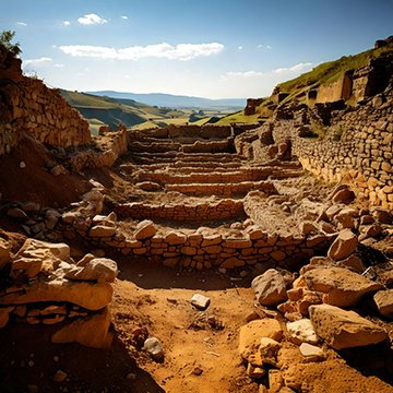
Ground Penetrating Radar (GPR) is an advanced geophysical method used to investigate the subsurface of the earth non-invasively. Utilizing radar pulses, GPR provides detailed imaging of buried structures, voids, and materials, making it an invaluable tool for industries like construction, archaeology, utility mapping, and environmental studies. This article delves into the working principles, applications, benefits, and limitations of GPR technology.
What is Ground Penetrating Radar (GPR)?
GPR is a geophysical method that employs electromagnetic waves to detect and map subsurface structures. By sending high-frequency radio waves into the ground, the technology measures the reflected signals to identify objects, changes in material, and voids.
Key Features:
- Non-destructive: GPR does not require digging or drilling.
- Versatile: Suitable for a variety of soil types and applications.
- High Resolution: Provides detailed imaging for precise analysis.
How Does GPR Work?
1. Transmission of Radar Waves
A GPR device sends electromagnetic waves into the ground using a transmitting antenna.
2. Reflection and Detection
When these waves encounter a boundary between materials with different electrical properties, some of the waves are reflected back to the surface.
3. Data Collection and Analysis
A receiving antenna detects the reflected waves, and the data is processed to create a visual representation of the subsurface.
Factors Influencing Performance:
- Soil Type: Clay and saline soils can attenuate signals.
- Depth: Penetration depth typically ranges from a few centimeters to several meters.
- Frequency: High-frequency waves offer better resolution but shallower penetration.
Applications of Ground Penetrating Radar
1. Utility Locating and Mapping
GPR is widely used to locate buried utilities such as pipes, cables, and conduits without excavation.
- Construction Projects: Ensure safety and avoid damage to existing infrastructure.
- Telecommunications: Identify fiber-optic cables for maintenance.
2. Archaeology and Cultural Heritage
Archaeologists use GPR to map and identify buried artifacts, structures, and burial sites.
- Preservation: Study sites without damaging them.
- Historical Research: Uncover ancient settlements and pathways.
3. Environmental Studies
GPR helps in monitoring environmental conditions and detecting underground contamination.
- Landfill Mapping: Identify buried waste and voids.
- Water Resources: Map aquifers and underground water channels.
4. Construction and Engineering
In construction, GPR assists in structural analysis and quality control.
- Rebar Detection: Locate reinforcement bars in concrete structures.
- Foundation Assessment: Evaluate the condition of existing foundations.
5. Forensic and Law Enforcement
GPR is used in criminal investigations to locate buried evidence.
- Missing Persons Cases: Detect human remains.
- Hidden Objects: Identify hidden caches or buried weapons.
Advantages of Ground Penetrating Radar
- Non-Invasive and Safe: Unlike drilling or excavation, GPR does not disturb the ground that’s why it’s great precaution before directional drilling. If you’re wondering what is directional drilling here is an explanation.
- Real-Time Results: Offers immediate data collection and analysis.
- Precision: Detects small objects and subtle changes in material.
- Versatility: Works across various industries and applications.
- Environmental Protection: Minimizes disruption to sensitive ecosystems.
Limitations of Ground Penetrating Radar
- Soil Conditions: Performance is reduced in conductive soils like clay or saline sands.
- Depth Penetration: Limited by the frequency of the radar waves.
- Operator Expertise: Requires skilled personnel to interpret data accurately.
- Cost: Initial equipment investment can be high.
The Future of GPR Technology
Technological advancements are enhancing the capabilities of GPR:
- Improved Imaging: Integration with 3D modeling software for detailed visualizations.
- Automation: Autonomous robots equipped with GPR for large-scale surveys.
- Multi-Frequency Systems: Offering better resolution and depth flexibility.
- AI and Machine Learning: Enhancing data interpretation accuracy.
Frequently Asked Questions (FAQs)
1. How deep can GPR detect?
GPR can typically penetrate depths ranging from a few centimeters to 30 meters, depending on soil conditions and frequency.
2. Is GPR safe for the environment?
Yes, GPR is non-invasive and eco-friendly, causing no harm to the environment.
3. Can GPR work in all soil types?
While GPR works in most soils, performance may decline in highly conductive soils like clay or saline sands.
4. How accurate is GPR for utility mapping?
GPR is highly accurate, often detecting utilities with precision up to a few centimeters. If you’re looking for precise mapping check out the best underground utility services.
5. What industries benefit most from GPR?
Industries like construction, archaeology, environmental studies, and law enforcement heavily rely on GPR technology.
6. Is GPR expensive to use?
While initial equipment costs can be high, the efficiency and precision of GPR often justify its expense.
Ground Penetrating Radar is a transformative technology with applications spanning utility mapping, archaeology, environmental studies, and more. Its ability to provide non-invasive, real-time subsurface imaging makes it invaluable for modern industries. While it has limitations in certain soil conditions, ongoing advancements in GPR technology continue to expand its potential. If you’re looking for GPR or how much does trenching cost you should look for a bid from local contractors. As a tool for exploration and discovery, GPR remains at the forefront of subsurface investigation, providing a window into what lies beneath our feet.


